West Anglian Orienteering Club
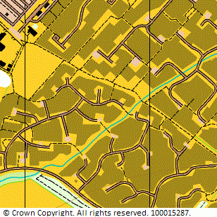
Bar Hill and Dry Drayton map
Near: Cambridge

Description
Terrain Description:
Street map of Bar Hill and Dry Drayton.
Suitable for small events and Street-O. MapRun course available.
Map Scale: 1:10000
Map Format: A4
Location
Nearest Town: Cambridge
Postcode: CB23 *
Lat,Lng: 52.25138,0.01854
Grid Ref: TL379634
Open an interactive map in a new tab using:
* Postcodes are not very precise in some areas, so don't rely on them for an exact location.
Images from the areaclick/tap photos for a larger version
Barhill