West Anglian Orienteering Club
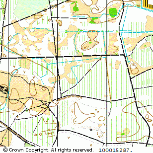
Bush Heath Wood map
Near: Mildenhall

Description
Terrain Description:
Jointly managed with CUOC.
Coniferous woodland with clearings in the northern part.
Suitable for local and regional events.
Map Scale: 1:10000
Map Format: A4
Location
Nearest Town: Mildenhall
Postcode: IP28 *
Lat,Lng: 52.35003,0.53309
Grid Ref: TL726754
Open an interactive map in a new tab using:
* Postcodes are not very precise in some areas, so don't rely on them for an exact location.
Images from the areaclick/tap photos for a larger version
Bush Heath