West Anglian Orienteering Club
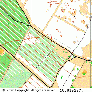
Croxton Heath map
Near: Thetford

Description
Terrain Description:
Block coniferous woodland in Thetford Forest.
Map Scale: 1:15000/1:10000
Map Format: A3
Location
Nearest Town: Thetford
Postcode: IP24 1LU *
Lat,Lng: 52.47062,0.75592
Grid Ref: TL877894
Open an interactive map in a new tab using:
* Postcodes are not very precise in some areas, so don't rely on them for an exact location.
Images from the areaclick/tap photos for a larger version
Croxton Heath