West Anglian Orienteering Club
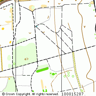
Mildenhall North map
Near: Mildenhall

Description
Terrain Description:
Runnable coniferous woodland of varying ages. Seperated from Mildenhall South by the A11.
Suitable for events up to Regional.
Map Scale: 1:10000
Map Format: A4
Location
Nearest Town: Mildenhall
Postcode: IP28 6AE *
Lat,Lng: 52.34722,0.54098
Grid Ref: TL735752
Open an interactive map in a new tab using:
* Postcodes are not very precise in some areas, so don't rely on them for an exact location.
Images from the areaclick/tap photos for a larger version
Mildenhall North