West Anglian Orienteering Club
Mildenhall South map
Near: Mildenhall

Description
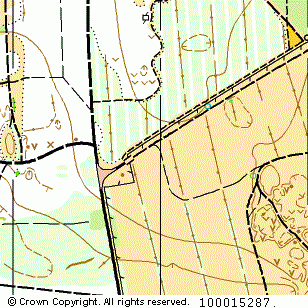
Terrain Description:
Runnable coniferous woodland and heathland with some contour detail. Separated from Mildenhall North by the A11.
Suitable for limited scale events up to Level C.
Map Scale: 1:10000
Map Format: A4
Location
Nearest Town: Mildenhall
Postcode: IP28 6PZ *
Lat,Lng: 52.33684,0.5604
Grid Ref: TL745740
Open an interactive map in a new tab using:
* Postcodes are not very precise in some areas, so don't rely on them for an exact location.
Images from the areaclick/tap photos for a larger version
Mildenhall South