West Anglian Orienteering Club
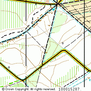
Rowney Wood map
Near: Saffron Walden

Description
Terrain Description:
Small wooded area of variable runnability. Suitable for small events.
Map Scale: 1:7500
Map Format: A4
Location
Nearest Town: Saffron Walden
Postcode: CB10 2YL *
Lat,Lng: 51.98651,0.2814
Grid Ref: TL567344
Open an interactive map in a new tab using:
* Postcodes are not very precise in some areas, so don't rely on them for an exact location.
Images from the areaclick/tap photos for a larger version
Rowney Wood